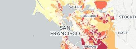
Below are examples of how to use the interactive maps.
Industrial Land
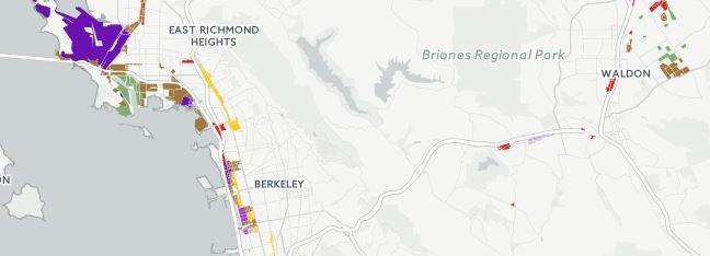
Select the Industrial Zones layer to explore the location of industrial land in the region. In the East Bay, much of the land is located along the waterfront. The East Bay is home to most of the region’s heavy industrial zones (in purple), much occupied by the refineries, former military bases, and the Port of Oakland. For more, see Technical Memo #1.
"The big opportunity is that our location puts us centrally located to our prime market area."
- Oakland business
"The overall cost [of a central location] remains higher but carries the advantage of proximity to so much talent and technical expertise associated with Silicon Valley."
- San Leandro business
"Due to the lower concentration of industrial businesses there is less synergy between companies in our area, higher transportation costs, and shortage of workers."
- West Berkeley business
Conflict Layer
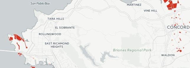
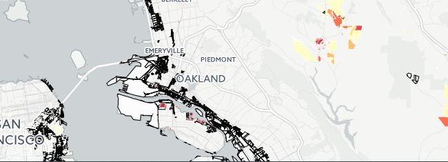
The Conflict layer highlights all of the land where the local General Plan designates industrially zoned land for residential, commercial, or other use. This land is likely to be converted in the near future and is an opportunity for developers seeking land for new housing and retail. For more information, see Technical Memo #2.
We have industrial uses adjacent to our complex, and we have parkland. There have been lots of fights between the parkland users and the industrial users. The commercial users didn't feel impacted and supported the industrial uses continuing where they are.
- Petaluma business
"We are in an industrial zone, but all around this zone are residences that built up after we were here, and this poses problems for noise and light in the area."
- East Oakland business
Industrial Zones Outline
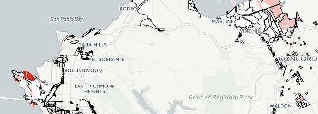
By adding the Industrial Zones Outline to the Conflict layer, it is possible to identify which industrially zoned parcels are likely to change use. In the nine-county Bay Area, 17% of industrial land is slated for conversion. For more information, see Technical Memo #2.
"It’s a challenge, in this area that there is a need for housing… demand for building housing wherever you can, versus industrial. How can that demand for housing pay for some of this [industrial space]?"
- Fremont business
"I agree that industrial uses can have a wide scope, but office not ancillary to manufacturing, retail and residential are not what should be here. Luckily, we own our building so the pricing impact is not significant. However, it would be nice not to have to worry about becoming an island."
- Berkeley business
Priority Development Areas
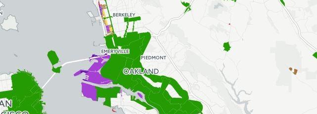
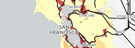
Adding the Priority Development Areas (in green) to the Industrial Zones layer shows the areas that cities have designated to receive most future residential and commercial development. As rents go up in these neighborhoods, many industrial businesses will be displaced. Overall 12% of the Bay Area’s industrial land will be redeveloped in this way. For more information, see Technical Memo #2.
"It’s good that we have the downtown and the BART coming up, but how is the cost, developers going to play out. My neighbor is moving out this month because the landlord raised the rent fifty percent; the next move may be to Nevada because the market pressure is coming up, and he is a solar innovator."
- Fremont business
"But development is proceeding and the already-high price pressure is increasing. It could well force many nearby enterprises out of business or out of the area. If we wanted to expand here, our options would be slim to none."
- Berkeley business
"We need to preserve our city's PDR [production, distribution, and repair] space. More and more residential and mixed-use facilities are encroaching on these areas."
- San Francisco business
Not all new development is in conflict with industrial land. This map overlays the Industrial Zones Outline on the Potential Density layer, which shows the sites that cities have identified for future housing development.
"Encourage new development that better utilizes its land inventory while also reserving the most valuable commercial and industrial corridors for businesses and industries likely to locate here given opportunity."
- Vallejo business
Business clusters
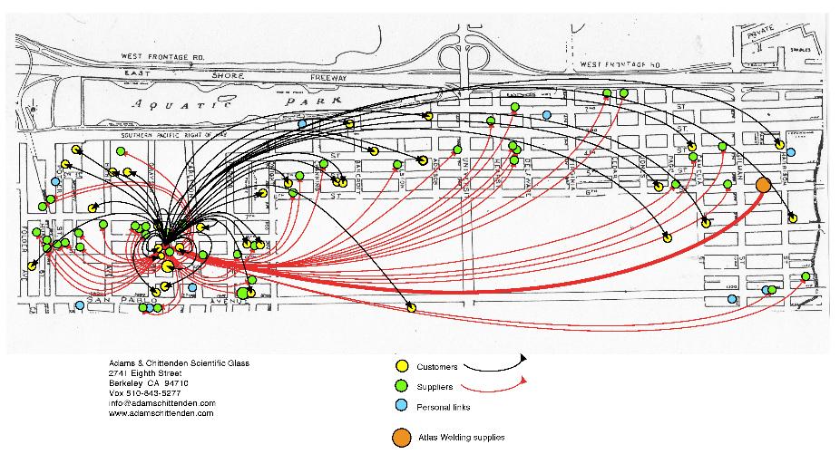
Businesses on industrial land have longstanding relationships with local customers and suppliers. As this map of a West Berkeley business network suggests, industrial districts support business clusters, which then help businesses stay competitive. For more information, see Technical Memo #5.
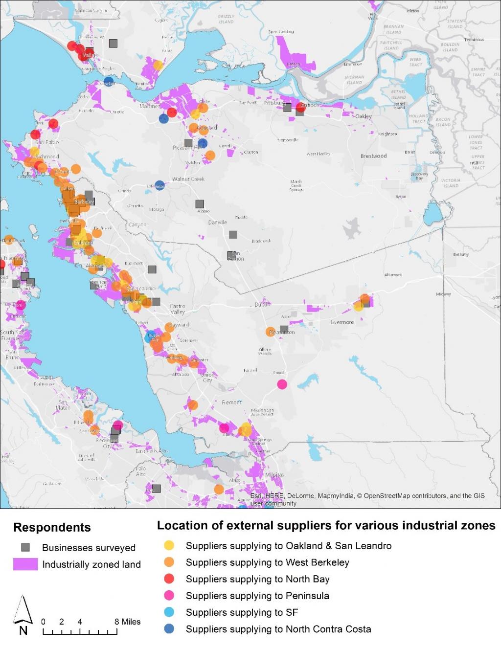
Our own survey of industrial businesses found that cities are connected by supplier networks concentrated in industrial areas. For more information, see Technical Memo #5.
Industrial Jobs
The 2013 Employment layer shows the location of jobs that depend on industrially zoned land – about 630,000 jobs total in the nine-county region. Most of this production, distribution, and repair employment is concentrated along major rail and freight corridors. For more information, see Technical Memo #1.
"The lack of affordable housing is now putting even more pressure on East Bay industrial acreage. Unfortunately, everyone seems to forget that […] facilitating business growth […] creates higher paying jobs."
- Oakland business
The Worker Home location shows where the workers in industrial jobs live. The biggest concentrations are in the East Bay. For more information, see Technical Memo #3.

